samper@samper.pl
INDEPENDENT IMAGE INFORMATION STUDY
Marek Ostrowski
Poland as the eagle flies
Education Triptych
The Warsaw Triptych
Warsaw as the eagle flies
The idea behind
Virtual walk
Gea - means the Earth
Image information
Emotion of Discovery
Atlas of Hematology
Temple of Providence
The Satellite Images
Polish national parks
Poland
Warsaw - aerial photos
Panorama of Warsaw
Thematic panoramas

 Next image
 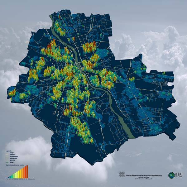 |
Aerial and satellite imaging, and the representations of Earth's surface drawn up on their basis, constitute the basis for constructing multidimensional thematic maps in contemporary society. On the photo: a three-dimensional presentation of the distribution of population density in Warsaw, expressed as the number of persons per unit of surface. Statistics about the number of inhabitants in particular buildings in Warsaw in 2005 were used to make the presentation. The Warsaw Map of Address Points (WAMP), which was put together by the Warsaw Office for Development Planning, S.A. and information (from 2005) acquired from the PESEL system were used for the work. The presentation was made using the ESRI programming environment, Arc GIS 9.1 tools, and the Spatial Analyst plug-in. |
samper@samper.pl
mobile (+48) 602 760031