samper@samper.pl
 |
|
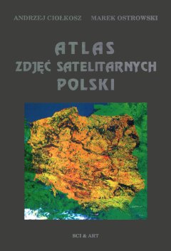
Atlas of Satellite Images of Poland
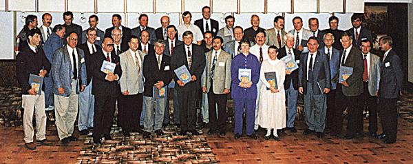
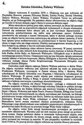
This is the first album of its kind in Poland and one of the first in the world, developed for the area of the whole country. It was written by two authors specializing in the aerial and satellite remote sensing: professor Andrzej Ciołkosz and dr Marek Ostrowski from the Aerial and Satellite Image Processing Centre and the Image Information Study at Warsaw University. It was published by SCI-ART (currently SAMPER) in 1995. The ceremonial handing over of the first copies of the book unofficially opened the World Space Flights Congress. The book and its authors were particularly honoured by signing of one of its copies by several cosmonauts from all over the world. The signed copy was then donated to the Warsaw University Library, together with a photo of all the participants in the Congress.
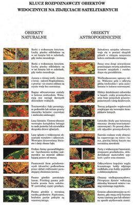
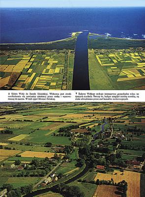
The Atlas consists of an Introduction and 20 blocks, each of which contains a satellite image, its verbal description and characteristic aerial photos of the given area and a map made in the same scale.
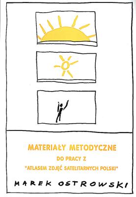
The map, which is hidden under the photo, and not placed next to it as many readers would expect, provokes an effort to work on the satellite image. This arrangement is one of the many assumptions that allow to use the Atlas in an educational programme. Such a programme, was created and realized by Marek Ostrowski and his Scientific Research Organization for several hundred schools throughout Poland and met with great success, creating a basis for a new generation of interdisciplinary educational programmes. It is based on the co-operation between a student (greater spontaneous perception and imagination) and a teacher (greater knowledge). It can be realized, based on eight different subjects, from the 4th grade of primary school up to the academic level. The Atlas of the Satellite Images of Poland was immediately incorporated into the educational programme with the use of methodology materials elaborated by teachers and methodologists.
The educational programme based on the Atlas of the satellite images of Poland received an Award from the Minister of Environmental Protection in 1996 during the I International Ecological Education Forum.


samper@samper.pl
mobile (+48) 602 760031